Help Obtaining HGT file for route creation.
First unread post • 11 posts
• Page 1 of 1
Help Obtaining HGT file for route creation.
![]() by snakeyez503 » Thu Jun 03, 2010 4:19 am
by snakeyez503 » Thu Jun 03, 2010 4:19 am
Ive searched quite a while but im still lost. The tutorials i find on this subject point to old obsolete websites for obtaining STRS. Ive done it once before using the USGS Seemless server for another game (not STRS data). Alot of posts on this topic are quite old. I can figure out the rest as soon as i have an hgt. file for portland oregon. Can someone give me a few detailed steps(the semeless server is a little complex) im confused buy all the dem 90m 3 second arc ect.
- snakeyez503
Re: Help Obtaining HGT file for route creation.
![]() by rgarber » Thu Jun 03, 2010 7:39 am
by rgarber » Thu Jun 03, 2010 7:39 am
I'm like you, I don't get all the DEM terminology and I only need to do it once a route. So what I recommend is getting ReDEM. Here's the link:
http://www.zugware.com/site/
Deanville has been doing DEMs stuff since the early days of MSTS (2001+) and it does a great job. It explains the whole process from download to implimentation. Works very good and once your DEMs are in place, you don't have to worry about the terminology anymore.
Rich
http://www.zugware.com/site/
Deanville has been doing DEMs stuff since the early days of MSTS (2001+) and it does a great job. It explains the whole process from download to implimentation. Works very good and once your DEMs are in place, you don't have to worry about the terminology anymore.
Rich
- rgarber
Re: Help Obtaining HGT file for route creation.
![]() by snakeyez503 » Fri Jun 04, 2010 12:55 am
by snakeyez503 » Fri Jun 04, 2010 12:55 am
ok so i have ReDem RWtools and am in the process of using Google Earth to develop a marker file, however im uncertain about if im able to use multiple ribbon markers(i.e. track) in a route. Does this mean i dismiss or swap references to .hgt files for dem.
Im a graphic design person so all this pseudo programing is a little bewildering.
My understanding so far... feel free to correct me.
use Google earth to get concordances, changed to decimal format under options. mark a center point and extreme top(N) bottom L and R. I used pushpins copy this info to get exact area from seamless server.
--------------------------------------------------------------------------------
usgs seamless server (i found 3 ended up using the old one i used beforehttp://seamless.usgs.gov/)
Dem =digital elevation file.
1m =native railworks (no ReDem needed) Low resolution/quality
1/3m =Common Modern US coverage (ReDem req?) way better quality
1/9m =advanced resolution (req ReDem) high detail (limited availability)(bill16 = error so download float)
-------------------------------------------------------------------------------
Use Google Earth(pushpins) to mark markers for stations and landmarks.
Use Google earth(paths) to draw out ribbon markers for mainlines rivers and roads.
export files as kmz
--------------------------------------------------------------------------------
use spreadsheet editor to rearrange and delete unnecessary data.
---------------------------------------------------------------------------------
tie it all together with redem?
in Gearth
I have a couple of main lines with spurrs traced out as well as union station and the rail yards marked with pins will add landmarks too. Planning on tracing the Max light rail lines tomorrow. I have things separated by sub folders in "My places" is this going to mess me up?
If only Rail works worked like a plug-in for Google earth and all we had to do was add props and rolling stock.
- snakeyez503
Re: Help Obtaining HGT file for route creation.
![]() by rgarber » Fri Jun 04, 2010 6:42 am
by rgarber » Fri Jun 04, 2010 6:42 am
Looks good to me. I confess though the first third of what you have listed I didn't do. Having done DEMs before I just skip the first third of what you listed and I just go download the DEMs I need directly. So like in my newest route I logged the counties the route runs in, and then downloaded those two counties (or regions, whatever the things are called) in Ohio. Didn't take long at all. I had done the markers in Google Earth first just so I knew how much of the route I was doing but my markers didn't factor in getting the dems applied. I treated the two separetly. Anyway, with the DEMs downloaded that's when I used ReDem to put the DEM data together and then copied the information to the actual folder in Railworks. You should probably stick to the instructions though and it looks like your catching on fast. 
Rich
Rich
- rgarber
Re: Help Obtaining HGT file for route creation.
![]() by BigVern » Sat Jun 05, 2010 9:49 pm
by BigVern » Sat Jun 05, 2010 9:49 pm
Be aware if using SRTM hgt data (the pre packaged stuff) from the NASA server, many of the DEM's even the more recent higher resolution versions have incomplete data or voids which translate into large cheese like holes when imported into RW (and there's no easy way of repairing them). If you've got ReDem working then certainly for a US route you're probably better off using the seamless data which avoids the problem, AFAIK.
Though having said that, even after buying and putting in the registration code I can't get ReDem out of demo mode, so it only creates terrain for half the route, leaving me stuck with using the NASA hgt.
Though having said that, even after buying and putting in the registration code I can't get ReDem out of demo mode, so it only creates terrain for half the route, leaving me stuck with using the NASA hgt.
- BigVern
Re: Help Obtaining HGT file for route creation.
![]() by Trainguy76 » Sun Jun 06, 2010 12:46 am
by Trainguy76 » Sun Jun 06, 2010 12:46 am
Hi, what I do is first create a route template in the Blueprint editor, then I create the route. Download the DEM directly, place it in it's designated folder, then press 't' in game. I use RW_tools, to do series markers only, as it is a bit quicker.
-
Trainguy76 - Posts: 630
- Joined: Mon Feb 15, 2010 12:46 am
- Location: San Bernardino, California
Re: Help Obtaining HGT file for route creation.
![]() by qrfan3 » Sun Jun 06, 2010 2:41 am
by qrfan3 » Sun Jun 06, 2010 2:41 am
BigVern wrote:Be aware if using SRTM hgt data (the pre packaged stuff) from the NASA server, many of the DEM's even the more recent higher resolution versions have incomplete data or voids which translate into large cheese like holes when imported into RW (and there's no easy way of repairing them).
In downunder land we have no data available for our area from the seamless server so I downloaded the best available ( 3 arc second hgt dems ) from the NASA site and converted them to BIL ( which ReDem only uses ) using Microdem. In the options of Microdem there are many choices to choose from and one of them is fill holes by a factor you can choose. This is done when merging all the dems ( if you covering a large area ) and before creating the BIL file.
My personal belief is ReDem is the only way to go as it does all the terrain in one hit and does a great job...whereas the "T" option in RW's does it tile by tile ( as far as I know..? )
-

qrfan3 - Posts: 443
- Joined: Sun Feb 28, 2010 11:38 pm
- Location: Downunder from the Sunshine State.
Re: Help Obtaining HGT file for route creation.
![]() by BigVern » Sun Jun 06, 2010 8:55 am
by BigVern » Sun Jun 06, 2010 8:55 am
I presume ReDem has been updated to cope with areas outside the US as I'm sure I read it was initially only for the localised territory.
I did try on a previous route to repair the DEM with Microdem and used the BILSRTM converter to save back into hgt. Unfortunately that resulted in all sorts of spikes appearing in the terrain instead! There are several programmes that can fill holey DEM - 3Dem and of course Transdem for Trainz - but none that save back into the hgt format.
Hopefully in a future update, RS.com will introduce DEM smoothing into the RW Editors.
- BigVern
Re: Help Obtaining HGT file for route creation.
![]() by qrfan3 » Sun Jun 06, 2010 9:45 am
by qrfan3 » Sun Jun 06, 2010 9:45 am
BigVern wrote:I presume ReDem has been updated to cope with areas outside the US as I'm sure I read it was initially only for the localised territory.
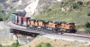
I live in Australia and just done terrain on a local Route using ReDem as described above with no problems at all. I have found no holes yet or spikes...here's a pic I posted at ReDem when trialling.
You do not have the required permissions to view the files attached to this post.
-
qrfan3 - Posts: 443
- Joined: Sun Feb 28, 2010 11:38 pm
- Location: Downunder from the Sunshine State.
Re: Help Obtaining HGT file for route creation.
![]() by BigVern » Sun Jun 06, 2010 2:50 pm
by BigVern » Sun Jun 06, 2010 2:50 pm
Just to clarify, the spiked terrain came after using the third party BILSRTM programme and copying the outputted hgt into the RW DEM folder, [i]not[i/] ReDem, which produced lovely results apart from the problem mentioned of not coming out of demo/freeware mode.
- BigVern
Re: Help Obtaining HGT file for route creation.
![]() by qrfan3 » Sun Jun 06, 2010 8:40 pm
by qrfan3 » Sun Jun 06, 2010 8:40 pm
Understood,...misread your previous thread..  and was not referring to ReDem causing the issue.
No doubt you have done so, got onto Deanville about the not coming out of demo mode. I know that the user ID & key have to be added EXACTLY the same into the registration dialog as sent in the email..spaces, caps..etc. I did goof up the first time.
Cheers.
and was not referring to ReDem causing the issue.No doubt you have done so, got onto Deanville about the not coming out of demo mode. I know that the user ID & key have to be added EXACTLY the same into the registration dialog as sent in the email..spaces, caps..etc. I did goof up the first time.
Cheers.
-
qrfan3 - Posts: 443
- Joined: Sun Feb 28, 2010 11:38 pm
- Location: Downunder from the Sunshine State.
11 posts
• Page 1 of 1
Who is online
Users browsing this forum: No registered users and 6 guests