As a follow up to my previous post I would like to announce what I've got coming (to wet your appetites =P.)
This route will consist of (in their entirety)...
Lehigh Line (Oak Island to Bethlehem)
National Docks Branch (Oak Island to Croxton)
Garden State Secondary (Oak Island to Perth Amboy)
Port Reading Secondary (Bound Brook to Port Reading)
and much more...
So needless to say there will be a lot to do on this route...
I'll have plenty of switching/local/and mainline running.
Stay tuned for more...
Ken
Central Jersey Freight Lines (The Lehigh Line Project)
Re: Central Jersey Freight Lines (The Lehigh Line Project)
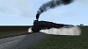
![]() by xxuntitledxx » Sun Oct 02, 2016 12:57 am
by xxuntitledxx » Sun Oct 02, 2016 12:57 am
- xxuntitledxx
- Posts: 430
- Joined: Tue Jun 25, 2013 5:02 pm
- Location: NJ
Re: Central Jersey Freight Lines (The Lehigh Line Project)
![]() by xxuntitledxx » Wed Oct 26, 2016 8:51 pm
by xxuntitledxx » Wed Oct 26, 2016 8:51 pm
Hi all,
Looking for some advice... I'm working on the Manville, NJ area and I have a big section of the area that is literally a HUGE parking lot. How would you guys go about doing this? I don't want to overdo it by trying to paint a million lines or something. I'm trying to make it believable to the point where it's recognizable but not a frame rate killer. So any ideas? I have a screenshot of Google earth so you guys see what I mean.
Ken
You do not have the required permissions to view the files attached to this post.
- xxuntitledxx
- Posts: 430
- Joined: Tue Jun 25, 2013 5:02 pm
- Location: NJ
Re: Central Jersey Freight Lines (The Lehigh Line Project)
![]() by minerman146 » Wed Oct 26, 2016 9:39 pm
by minerman146 » Wed Oct 26, 2016 9:39 pm
Divide by lot with road, paint dark grey with light grey highlights. Use preformed parking lots, dense close to track, random in distance, curbs in foreground, match lighting with google earth. Keep an eye on asset count, sparingly use single cars to break up repetition. Make it perfectly flat to ease asset placement. Check google and bing street view against your model.
"In business, I prefer to keep company with honest men, so I ship on the Erie"
-

minerman146 - Posts: 2507
- Joined: Fri Mar 20, 2015 8:15 pm
- Location: Cornwall, New York
Re: Central Jersey Freight Lines (The Lehigh Line Project)
![]() by buzz456 » Thu Oct 27, 2016 5:52 pm
by buzz456 » Thu Oct 27, 2016 5:52 pm
My question as usual is what can you see from trackside? I have no urge to make scenery that looks nice from a helicopter two or three thousand feet up. All that does is gag everyone's computer to the point where the route becomes un runnable. And that defeats the whole purpose. For instance how far away can you see the lines in a parking lot?
Buzz
39 and holding.
"Some people find fault like there's a reward for it."- Zig Ziglar
"If you can dream it you can do it."- Walt Disney

39 and holding.
"Some people find fault like there's a reward for it."- Zig Ziglar
"If you can dream it you can do it."- Walt Disney
-
buzz456 - Site Admin
- Posts: 21274
- Joined: Sun Mar 21, 2010 8:30 am
- Location: SW Florida
Re: Central Jersey Freight Lines (The Lehigh Line Project)
![]() by xxuntitledxx » Thu Oct 27, 2016 8:59 pm
by xxuntitledxx » Thu Oct 27, 2016 8:59 pm
Well I'll probably find out how far you can really see on Saturday since I'll be on the tracks in the Amtrak Autumn Special (yes I got tickets lucky me) and I will probably be on the engineer's side most likely. So I will definitely see what I can see from a first person's perspective. Other than that I might be able to see in detail maybe a hundred or two hundred feet(ish) from the tracks. I think I'm gonna see what the view looks like from an areal view as well as on saturday first person. Probably shoot video of it too for reference.
- xxuntitledxx
- Posts: 430
- Joined: Tue Jun 25, 2013 5:02 pm
- Location: NJ
Re: Central Jersey Freight Lines (The Lehigh Line Project)
![]() by xxuntitledxx » Wed May 10, 2017 9:28 pm
by xxuntitledxx » Wed May 10, 2017 9:28 pm
Hi All,
Just wanted to give you an update on the goings on of the development of this route...
So I'm working on scenery... and there's LOTS to be done. Currently working section by section. Right now I'm doing scenery on the Trenton Sub into Manville, NJ. I'll be then working Conrail east and NS west.
Also, I'm fine tuning things as I go.
So needless to say things have kind of come to a crawl as scenery work is done. I'll be posting pictures as I go along.
Also, with pictures in mind I'd like to post a question to everyone.
What spot do you think defines the Lehigh Line? I would like to get screenshots for the route predominantly featuring NS, but also featuring any other lines that feed into it (i.e. Conrail/CSX) so I would like to see a list of where you'd like screenshots and then I'll decide which should be the route photo ultimately.
So yeah, just wanted to give you guys an update (although short) and hopefully I'll have some content soon.
- xxuntitledxx
- Posts: 430
- Joined: Tue Jun 25, 2013 5:02 pm
- Location: NJ
Re: Central Jersey Freight Lines (The Lehigh Line Project)
![]() by xxuntitledxx » Thu Jul 13, 2017 9:27 pm
by xxuntitledxx » Thu Jul 13, 2017 9:27 pm
Hey all,
Quick update...
I've been working on the Doremus Auto Facility Area. Here's some WIP pics of what I've got so far...
As always let me know what you think... and comments are always welcomed.
Ken
Quick update...
I've been working on the Doremus Auto Facility Area. Here's some WIP pics of what I've got so far...
As always let me know what you think... and comments are always welcomed.
Ken
You do not have the required permissions to view the files attached to this post.
- xxuntitledxx
- Posts: 430
- Joined: Tue Jun 25, 2013 5:02 pm
- Location: NJ
Re: Central Jersey Freight Lines (The Lehigh Line Project)
![]() by ET44C4 » Thu Jul 13, 2017 9:37 pm
by ET44C4 » Thu Jul 13, 2017 9:37 pm
I like the auto facility so far. Keep up the good work! 
**Not taking any requests**
Santa Fe All The Way
Nothing Runs Like a Deere
No Farms No Food
Ford Powerstroke
My 87 Ford: https://www.youtube.com/channel/UCvNRba ... _tNs53k42w
Santa Fe All The Way
Nothing Runs Like a Deere
No Farms No Food
Ford Powerstroke
My 87 Ford: https://www.youtube.com/channel/UCvNRba ... _tNs53k42w
-

ET44C4 - Posts: 3187
- Joined: Mon Aug 22, 2016 12:01 pm
- Location: Clover, South Carolina
Re: Central Jersey Freight Lines (The Lehigh Line Project)
![]() by JohnS » Fri Jul 14, 2017 6:56 am
by JohnS » Fri Jul 14, 2017 6:56 am
With the Lehigh Line being modeled is there a chance this will include a portion of the NJT Raritan line? NJT shares Track with NS from CP NK to CP Aldene and also has a few miles of parallel trackage. I wasn't sure if you planned on adding the NJT Raritan Line in it's entirety either. Just a thought, either way it will be great to see more places I use to run trains.
-

JohnS - Posts: 1116
- Joined: Sun Dec 29, 2013 6:48 am
- Location: Portage IN
Re: Central Jersey Freight Lines (The Lehigh Line Project)
![]() by italianbattalion » Mon Jul 17, 2017 5:47 pm
by italianbattalion » Mon Jul 17, 2017 5:47 pm
Ken, looks great. Keep up the good work!
- italianbattalion
- Posts: 27
- Joined: Sat Nov 02, 2013 11:02 am
Re: Central Jersey Freight Lines (The Lehigh Line Project)
![]() by xxuntitledxx » Mon Jul 17, 2017 7:47 pm
by xxuntitledxx » Mon Jul 17, 2017 7:47 pm
JohnS wrote:With the Lehigh Line being modeled is there a chance this will include a portion of the NJT Raritan line? NJT shares Track with NS from CP NK to CP Aldene and also has a few miles of parallel trackage. I wasn't sure if you planned on adding the NJT Raritan Line in it's entirety either. Just a thought, either way it will be great to see more places I use to run trains.
I have just a small section from Cranford Station to Newark Penn Station. I also have the section that parallels the Lehigh Line from Middlesex to Bound Brook and a little bit beyond. But nothing complete. I am planning on doing NJ Transit AI traffic in scenarios.
- xxuntitledxx
- Posts: 430
- Joined: Tue Jun 25, 2013 5:02 pm
- Location: NJ
Re: Central Jersey Freight Lines (The Lehigh Line Project)
![]() by JohnS » Tue Jul 18, 2017 6:50 am
by JohnS » Tue Jul 18, 2017 6:50 am
xxuntitledxx wrote:JohnS wrote:With the Lehigh Line being modeled is there a chance this will include a portion of the NJT Raritan line? NJT shares Track with NS from CP NK to CP Aldene and also has a few miles of parallel trackage. I wasn't sure if you planned on adding the NJT Raritan Line in it's entirety either. Just a thought, either way it will be great to see more places I use to run trains.
I have just a small section from Cranford Station to Newark Penn Station. I also have the section that parallels the Lehigh Line from Middlesex to Bound Brook and a little bit beyond. But nothing complete. I am planning on doing NJ Transit AI traffic in scenarios.
That sounds great.

-
JohnS - Posts: 1116
- Joined: Sun Dec 29, 2013 6:48 am
- Location: Portage IN
Re: Central Jersey Freight Lines (The Lehigh Line Project)
![]() by xxuntitledxx » Wed Jul 19, 2017 10:38 pm
by xxuntitledxx » Wed Jul 19, 2017 10:38 pm
Here's a little work in progress shot of Newark by Dayton/Weequahic Park. Still have some foliage to put in place and some other details.
You do not have the required permissions to view the files attached to this post.
- xxuntitledxx
- Posts: 430
- Joined: Tue Jun 25, 2013 5:02 pm
- Location: NJ
Re: Central Jersey Freight Lines (The Lehigh Line Project)
![]() by ET44C4 » Wed Jul 19, 2017 10:45 pm
by ET44C4 » Wed Jul 19, 2017 10:45 pm
You're doing a pretty good job on placing the vegetation.
**Not taking any requests**
Santa Fe All The Way
Nothing Runs Like a Deere
No Farms No Food
Ford Powerstroke
My 87 Ford: https://www.youtube.com/channel/UCvNRba ... _tNs53k42w
Santa Fe All The Way
Nothing Runs Like a Deere
No Farms No Food
Ford Powerstroke
My 87 Ford: https://www.youtube.com/channel/UCvNRba ... _tNs53k42w
-
ET44C4 - Posts: 3187
- Joined: Mon Aug 22, 2016 12:01 pm
- Location: Clover, South Carolina
Re: Central Jersey Freight Lines (The Lehigh Line Project)
![]() by xxuntitledxx » Thu Aug 24, 2017 9:44 pm
by xxuntitledxx » Thu Aug 24, 2017 9:44 pm
Hey all,
So I am slowly getting work done on Newark/Oak Island. I hope to get it more accurate after my trip in October (Amtrak Autumn Express is going through Oak Island and down the National Dock's Secondary ) so i'll be able to document what's under the highway bridges. But anyway that aside. What do you guys suggest for doing large city areas. I don't need to be super-detailed more than 2000 feet off the tracks. Could I get away with "city block" assets or do you suggest me still laying individual buildings. Using the Minerman146 rule of thumb of 1000 feet I'd have a majority of Newark on the sides of all my track with little slits of no scenery (kind of odd?). It'll be like this for a majority of the Conrail end of the route. Any suggestions appreciated.
Also any ideas on how to attack the Garden State Secondary and Port Newark would be helpful too.
Thanks!
Ken
P.S. I should have some progress shots up soon of Oak Island. It's coming along...slowly...
So I am slowly getting work done on Newark/Oak Island. I hope to get it more accurate after my trip in October (Amtrak Autumn Express is going through Oak Island and down the National Dock's Secondary
) so i'll be able to document what's under the highway bridges. But anyway that aside. What do you guys suggest for doing large city areas. I don't need to be super-detailed more than 2000 feet off the tracks. Could I get away with "city block" assets or do you suggest me still laying individual buildings. Using the Minerman146 rule of thumb of 1000 feet I'd have a majority of Newark on the sides of all my track with little slits of no scenery (kind of odd?). It'll be like this for a majority of the Conrail end of the route. Any suggestions appreciated.Also any ideas on how to attack the Garden State Secondary and Port Newark would be helpful too.
Thanks!
Ken
P.S. I should have some progress shots up soon of Oak Island. It's coming along...slowly...
- xxuntitledxx
- Posts: 430
- Joined: Tue Jun 25, 2013 5:02 pm
- Location: NJ
Who is online
Users browsing this forum: No registered users and 8 guests