Bad news and good news; bad news first: I've ceased working on this route after realizing I was creating a "lame duck". I was constantly putting "band-aids" on things because it wasn't done properly from the start; simply because I didn't know (or understand) any better at the time. Some of the underlying factors are listed below:
1. The route uses the Penn Coal route-template and track rules, rather than my own. Hence everything references Penn Coal geography, route markers, etc. This also created problems with using the correct geographic zone (10 vs 7).
2. I could not achieve the degree of super-elevated curves used on the actual route, due to usage of the Penn Coal track rule.
3. I could not import route markers, because their coordinates had to be applied to the Penn Coal marker list. This resulted in a mixture of locations from both routes. I ceased using the Google Map api since their personal credit card registration requirement; and without route markers, I had to resort to using direction and distance from existing known points in order to place key objects.
4. I was using over a dozen payware routes for assets; one of them (Soldier Summit) just for some cat-tail reeds that aren't available in any other routes. Most of these routes had only one or two assets that closely matched features on the actual route; but unless anyone has actually been there, they wouldn't know the difference.
5. I was using two USA-only routes, Marias Pass and Stevens Pass, that basically excluded every non-US member of our community. Not cool when half the stuff on my hard-drive is from non-US contributors. So the whole concept of "take from everyone, but only give back to US members" wasn't sitting too well.
6. I was using low-res DEM data (3sec). After seeing hi-res (1sec) data applied, I just couldn't go back. Way too much terrain-shaping involved with the low-res data; and hi-res simply looks better in hilly terrain.
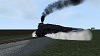
7. I was experiencing far too many broken track sections on easements and turn-outs, and relaying track or forcing things to work. I could never be confident there wouldn't be another track-break lurking around the next bend. I was cringing every time I placed a new section of track for fear that another problem would arise. I could lay a piece of track in one area, then go back and find broken frogs and switch points in totally un-related areas.
8. Penn Coal switch machines; never seen anything like 'em. I'm sure they exist somewhere, but not in my neck of the woods. Same with the grey ballast; it's nothing like the rusty brown stuff I remember walking on. So no matter how well I might have "finished" the route; it would never have the visual accuracy or "feel" I was after.
9. DEM data vs file size; I had imported data to include Mt St Helens and was contemplating Mt Rainier, when I realized that simply adding Mt St Helens had increased the filesize by 5x. After generating distant scenery, the peaks were not all that noticeable anyway. Unfortunately, I know of no method to "un-import" DEM data. Before I imported the DEM data, I also tried the "flat mock-up" technique, which is basically like a giant drive-in movie screen with distant scenery on it; it looks okay from cab-view, but once flying around outside the cab it looks like.., well.. a giant drive-in movie screen with scenery on it.
10. Inexperience. I started painting flight-sim airplanes in 2004, so transitioning to train-painting was fairly painless. So I supposed that route-building couldn't be all that difficult either. I studied video and documentation on the subject, and although I still didn't have all the answers, I thought I knew enough to make a decent go of it. But in the end, I only knew enough to mess things up. But I must admit, all those mistakes were things that forced me to learn the correct way of doing things. So the route I had envisioned as my creative masterpiece, has now become just another practice-route.
...and now, the good news!
I'm building the route again from the ground up; it's titled the "Inland Empire", which is an old moniker for the region. Key points follow:
1. Made my own route template and track rules. No dependencies on other route folders, and absolutely no issues importing route markers.
2. Using hi-res DEM data (1"). As a result, I'm working exclusively in 64-bit, to include laying track. I've already completed half the mainline, featuring super-elevated curves; all okay so far.
3. Did away with the massive payware and US-only requirements. Currently, the route requires the following payware:
a. Konstanz-Villingen (environment textures, sky, weather).
b. VNHRR (trackage)
c. GN Cascadian (Northwest-related objects).
Alas, the primary assets for the Centralia Steam Plant were in the Stevens Pass route, but the steam plant was out of the intended time zone anyway. So it's probably going to be nothing more than a big construction site when I get around to it.
4. Less route requirements equates to a much more pleasant building experience; not having to scroll through hundreds of objects and try to memorize them all. Saves time too. I'm also not going to activate any freeware assets until it's time to start putting on the finishing touches. "Less is more" during this phase of building.
Unfortunately, since the route is "born again", it's still going to be a while before releasing anything. So for all intents and purposes, this thread is dead. I'll start a new thread for the "Inland Empire" and post some screenshots once I progress with the scenery; but for now I'm back in the track-laying business.
Cheers!


 Besides, in the hilly terrain and tall trees of the area, there are only a few places (relatively speaking) to view the volcanic peaks from ground level. Usually, the best viewing sites were from logging clear-cuts. Of course if we get some folks saying they like the distant Cascade scenery, despite the file-size, I suppose I could always add the DEM data to a second "Director's Cut" version of the route (?). I've already considered doing this with regards to assets; little details like those cat-tail reeds from Soldier Summit and the fisherman from Koln-Koblenz.