I've finally decided it's time to take the plunge and do a North American route for Railworks. I've previously started a couple of projects (Utah Potash, California Western, McCloud River) which unfortunately ended up in the Fallen Flags bin.
I'm currently evaluating a few possibilities - California Western is looking top of the list as those twisting curves climbing the mountain towards Willits are irresistible.
However I was also thinking Canadian, maybe part of the CP in the Salmon Arm area though I know someone else is working on a Selkirk historical route and I wouldn't want to duplicate, albeit mine would be from a modern(ish) perspective. Another offbeat one that came to mind is a SF MUNI line, maybe N Judah, but like my recent UK ng project there's a bit of chicken and egg - without appropriate trams to run on it there seems little point in creating the route.
The other biggie I'm surprised not to see WIP is Tehachapi, think I may have seen something at TS about that a while back but no recent news.
My biggest problem at the moment is attention span building a route, anything over about 6 weeks = 25-30 miles and my mind wanders off. Now a 30 mile "budget" will build an intensive UK route thanks to our crowded little island but in the US or Canada that's barely the distance between two towns. Guess the advantage being it is (slightly) quicker to scenify a wilderness area than a townscape.
At the moment California Western is looking favourite (again). I'm an addict of mountain railroading and the shortline nature means train lengths and infrastructure can be kept fairly short.
Considering A North American Route
Re: Considering A North American Route
![]() by Trainguy76 » Thu Aug 26, 2010 11:48 am
by Trainguy76 » Thu Aug 26, 2010 11:48 am
The Tehachapi at TS.com is pretty much just the loop and that's it. I don't think it's even put in the right geological position. (I checked)
-
Trainguy76 - Posts: 630
- Joined: Mon Feb 15, 2010 12:46 am
- Location: San Bernardino, California
Re: Considering A North American Route
![]() by arizonachris » Thu Aug 26, 2010 4:33 pm
by arizonachris » Thu Aug 26, 2010 4:33 pm
I thought someone here was doing a Tehachapi route. *sigh* Now I'll have do do some searching.
Vern, I would love a new North American route. I have pretty much run the Barstow/ San Bernadino and Rich Garber's routes to death.
Vern, I would love a new North American route. I have pretty much run the Barstow/ San Bernadino and Rich Garber's routes to death.
Ryzen 7 2700K, Asus Prime X570P, 32Gb DDR4, 2x 1Tb M.2 SSD's, RTX2060 6Gb, Occulus Rift
Win 10 Pro 64bit, keyboard/ mouse/ wheel/ pedals/ baseball bat
Win 10 Pro 64bit, keyboard/ mouse/ wheel/ pedals/ baseball bat
Security Coordinator on the Battleship Iowa
-

arizonachris - Posts: 3955
- Joined: Sun Mar 21, 2010 10:36 am
- Location: Southern California
Re: Considering A North American Route
![]() by BigVern » Thu Aug 26, 2010 4:47 pm
by BigVern » Thu Aug 26, 2010 4:47 pm
As things stand at present I've decided to take another crack at California Western. There will be a (slight) interruption in progress during October as I'm taking part in the UKTS Route Building Challenge, but at 40 miles based on my normal rate of progress that could be a release candidate by mid to late December. We shall see!
If the others are still "vacant", who knows next year, I might take a crack at Tehachapi or Durango & Silverton.
If the others are still "vacant", who knows next year, I might take a crack at Tehachapi or Durango & Silverton.
- BigVern
Re: Considering A North American Route
![]() by dejoh » Thu Aug 26, 2010 5:09 pm
by dejoh » Thu Aug 26, 2010 5:09 pm
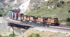
If you have run those two popular routes to death, try the P&LE
You do not have the required permissions to view the files attached to this post.
-

dejoh - Posts: 1478
- Joined: Mon Feb 16, 2009 5:08 pm
- Location: So. Chicago Heights, Il.
Re: Considering A North American Route
![]() by CerealKiller » Fri Aug 27, 2010 2:56 pm
by CerealKiller » Fri Aug 27, 2010 2:56 pm
tehachapi pass is in the DL section at TS. but? it woulda been helpfull if the author would have included the markers and the terrain files.
- CerealKiller
Re: Considering A North American Route
![]() by Trainguy76 » Fri Aug 27, 2010 4:06 pm
by Trainguy76 » Fri Aug 27, 2010 4:06 pm
CerealKiller wrote:tehachapi pass is in the DL section at TS. but? it woulda been helpfull if the author would have included the markers and the terrain files.
Trainguy76 wrote:The Tehachapi at TS.com is pretty much just the loop and that's it. I don't think it's even put in the right geological position. (I checked)
It's not in the right place, so there is no terrain possibilities.
-
Trainguy76 - Posts: 630
- Joined: Mon Feb 15, 2010 12:46 am
- Location: San Bernardino, California
Re: Considering A North American Route
![]() by BigVern » Sat Aug 28, 2010 9:29 am
by BigVern » Sat Aug 28, 2010 9:29 am
I'll put Tehachapi on the "maybe" list for next year then, if no one else is having a more accurate attempt in the meantime.
- BigVern
Re: Considering A North American Route
![]() by Trainguy76 » Sat Aug 28, 2010 12:13 pm
by Trainguy76 » Sat Aug 28, 2010 12:13 pm
BigVern wrote: if no one else is having a more accurate attempt in the meantime.
*Cough*

I'm just passing the time until the Route Building Challenge.
Feel free to extend it when I'm done.
-
Trainguy76 - Posts: 630
- Joined: Mon Feb 15, 2010 12:46 am
- Location: San Bernardino, California
Re: Considering A North American Route
![]() by BigVern » Sat Aug 28, 2010 11:37 pm
by BigVern » Sat Aug 28, 2010 11:37 pm
Off to a reasonable start on CWRR with Willits in and the line through Summit and through the winding curves down the hill. Some of those needed 70m radius curves so will be a bit limited what can run up there (given there's several 3.5% grades too) in terms of motive power and tonnage. Should be plenty of flange squeal though!
- BigVern
Re: Considering A North American Route
![]() by arizonachris » Sun Aug 29, 2010 10:42 am
by arizonachris » Sun Aug 29, 2010 10:42 am
OK, I have the DD40, the Challenger and the Big Boy. I suppose those should run that grade. 
Ryzen 7 2700K, Asus Prime X570P, 32Gb DDR4, 2x 1Tb M.2 SSD's, RTX2060 6Gb, Occulus Rift
Win 10 Pro 64bit, keyboard/ mouse/ wheel/ pedals/ baseball bat
Win 10 Pro 64bit, keyboard/ mouse/ wheel/ pedals/ baseball bat
Security Coordinator on the Battleship Iowa
-
arizonachris - Posts: 3955
- Joined: Sun Mar 21, 2010 10:36 am
- Location: Southern California
Re: Considering A North American Route
![]() by Toripony » Sun Aug 29, 2010 6:08 pm
by Toripony » Sun Aug 29, 2010 6:08 pm
I was looking at the WCRR on Google Earth.... are you sure that section is a railway?! It looks more like a ski trail!! lol That looks like a run I will enjoy.
Tori
Tori
-

Toripony - Posts: 1083
- Joined: Thu Jun 04, 2009 3:13 am
Re: Considering A North American Route
![]() by BigVern » Sun Aug 29, 2010 10:01 pm
by BigVern » Sun Aug 29, 2010 10:01 pm
@Chris...
I think the problem with the "big" power is getting round the curves, though I guess in a simulated world as you're really running on a database line you will probably get round any curve regardless of wheelbase. Not sure how RW approaches the physics of curve flange resistance. I was thinking more a BritKits RS3 or GP7/GP9.
@Tori...
My thoughts on seeing it too. Thus far it's defied two attempts on my part to see it through, the first in TS2009, which really couldn't cope with the precision needed for those sharp curves and second last year in RW when I got distracted by something else.
- BigVern
Re: Considering A North American Route
![]() by Hawk » Mon Aug 30, 2010 6:38 am
by Hawk » Mon Aug 30, 2010 6:38 am
BigVern wrote:though I guess in a simulated world as you're really running on a database line you will probably get round any curve regardless of wheelbase. Not sure how RW approaches the physics of curve flange resistance.
It could be that RW's physics in this matter is different than it was with MSTS (although both were created by Kuju), but if you'll remember in MSTS some of the longer rolling-stock would hang on sharp curves.
However, in my limited time in the RW editor laying track, I don't think RW can produce as sharp of a curve as was available in MSTS.
- Hawk
Re: Considering A North American Route
![]() by Trainguy76 » Mon Aug 30, 2010 12:50 pm
by Trainguy76 » Mon Aug 30, 2010 12:50 pm
It is possible to create quite sharp curves in RailWorks, all that is needed is your own track-rule.
-
Trainguy76 - Posts: 630
- Joined: Mon Feb 15, 2010 12:46 am
- Location: San Bernardino, California
17 posts
• Page 1 of 2 • 1, 2
Who is online
Users browsing this forum: No registered users and 5 guests